The Tutor/Mentor Institute has been piloting the uses of Geographic Information Systems maps since 1993 in an effort to show where volunteer-based tutor/mentor programs are most needed and as part of an effort to draw needed resources, talent and technology to each location so they are able to constantly innovate ways to sustain and improve their impact.
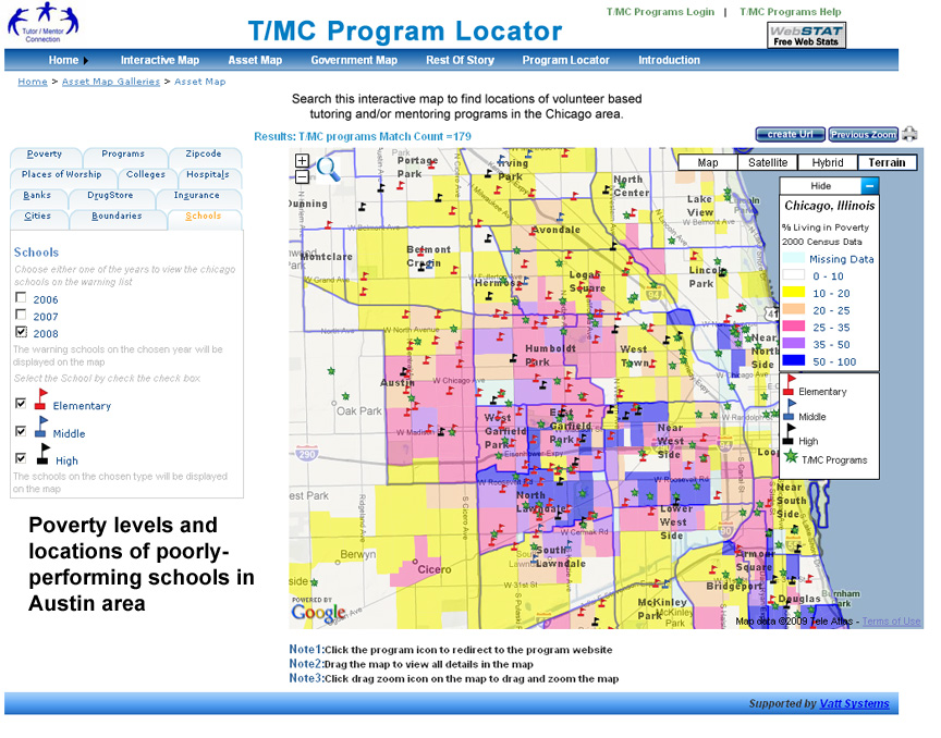
This is one map created using the Interactive
Tutor/Mentor Program Locator. See articles about
uses of maps in the Tutor/Mentor Institute strategy.
This strategy combines the work of collecting, organizing and sharing the information with the work that needs to be done to create greater public awareness and draw volunteers and donors to each of the programs on the map. Communities can zoom into specific areas and learn what programs are available, what age groups are served and what business, faith, university and hospital assets are in the same geography. If there are too few programs the maps can be used to help plan the most cost-effective locations for new programs.